
CLOSE MORE JOBS
WITH VISUAL PROOF
Help clients understand foundation conditions
and your repair recommendations instantly.
No Contract ● One Month Free ● Cancel Anytime
Secure signup powered by Stripe
CLOSE MORE JOBS WITH VISUAL PROOF
Help clients understand foundation conditions and your repair recommendations instantly.
No Contract ● One Month Free ● Cancel Anytime
Secure signup powered by Stripe


FAQS
Why is credit card information required?
Your free trial automatically transitions into a monthly subscription after 30 days unless canceled beforehand.
Can I cancel my trial at any time?
Yes. You can cancel anytime during your free trial with no penalties or long-term commitment.
What happens if I don't cancel my trial?
Your subscription automatically transitions into monthly billing based on the number of registered users on your account.
Once my trial period has ended, am I stuck in a contract?
No. SpatialVision™ is month-to-month with no long-term contracts. You can cancel anytime.
FAQS
Why is credit card information required?
Your free trial automatically transitions into a monthly subscription after 30 days unless canceled beforehand.
Can I cancel my trial at any time?
Yes. You can cancel anytime during your free trial with no penalties or long-term commitment.
What happens if I don't cancel my trial?
Your subscription automatically transitions into monthly billing based on the number of registered users on your account.
Once my trial period has ended, am I stuck in a contract?
No. SpatialVision™ is month-to-month with no long-term contracts. You can cancel anytime.
SIMPLE, STRAIGHTFORWARD PRICING
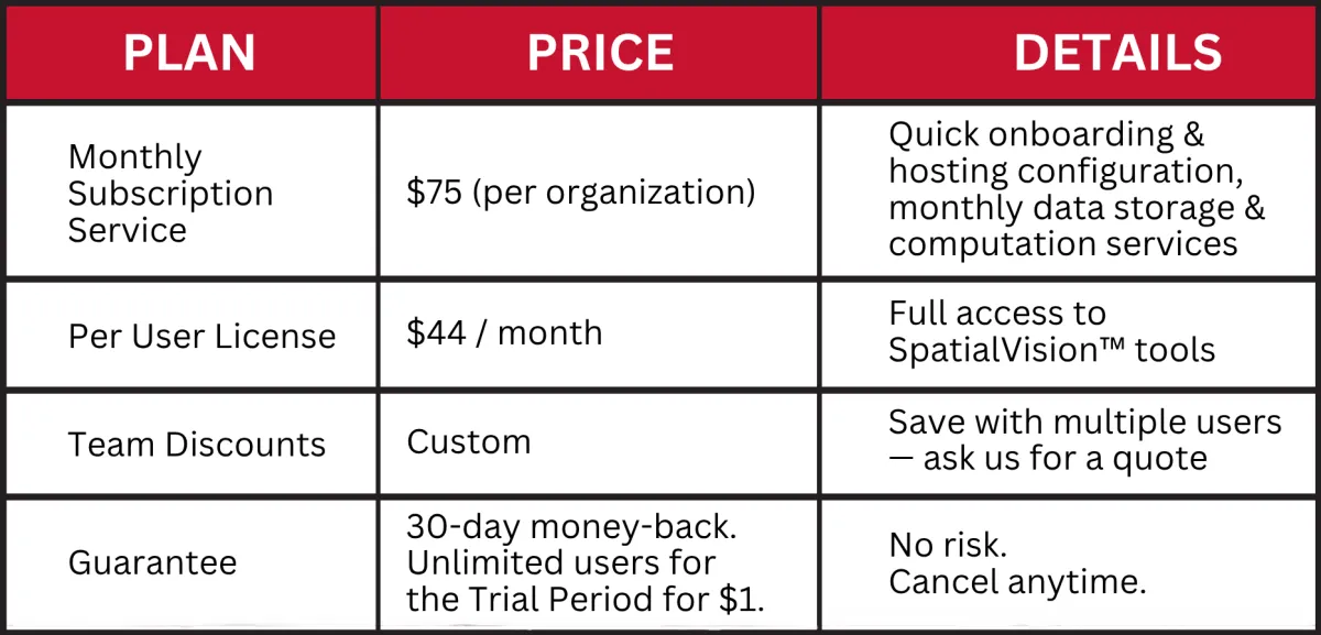
SAMPLE PRICING BREAKDOWN:
1 organization with 1 user
Month 1: $1 (30-Day Trial)
Month 2 and onwards: $75 + 44 = $119
1 organization with 2 users
Month 1: $1 (30-Day Trial)
Month 2 and onwards: 75 + $44 + $44 = $163
$1 is your credit card provider's verification requirement. The 30-day trial is absolutely free.
⚙️ Need multi-seat access or enterprise support? Contact us for custom pricing. ⚙️
SIMPLE, STRAIGHTFORWARD PRICING
SAMPLE PRICING BREAKDOWN:
1 organization with 1 user
Month 1: $1 (30-Day Trial)
Month 2 and onwards: $75 + 44 = $119
1 organization with 2 users
Month 1: $1 (30-Day Trial)
Month 2 and onwards: 75 + $44 + $44 = $163
$1 is your credit card provider's verification requirement. The 30-day trial is absolutely free.
⚙️ Need multi-seat access or enterprise support? Contact us for custom pricing. ⚙️
Make Faster, More Confident
Job Decisions
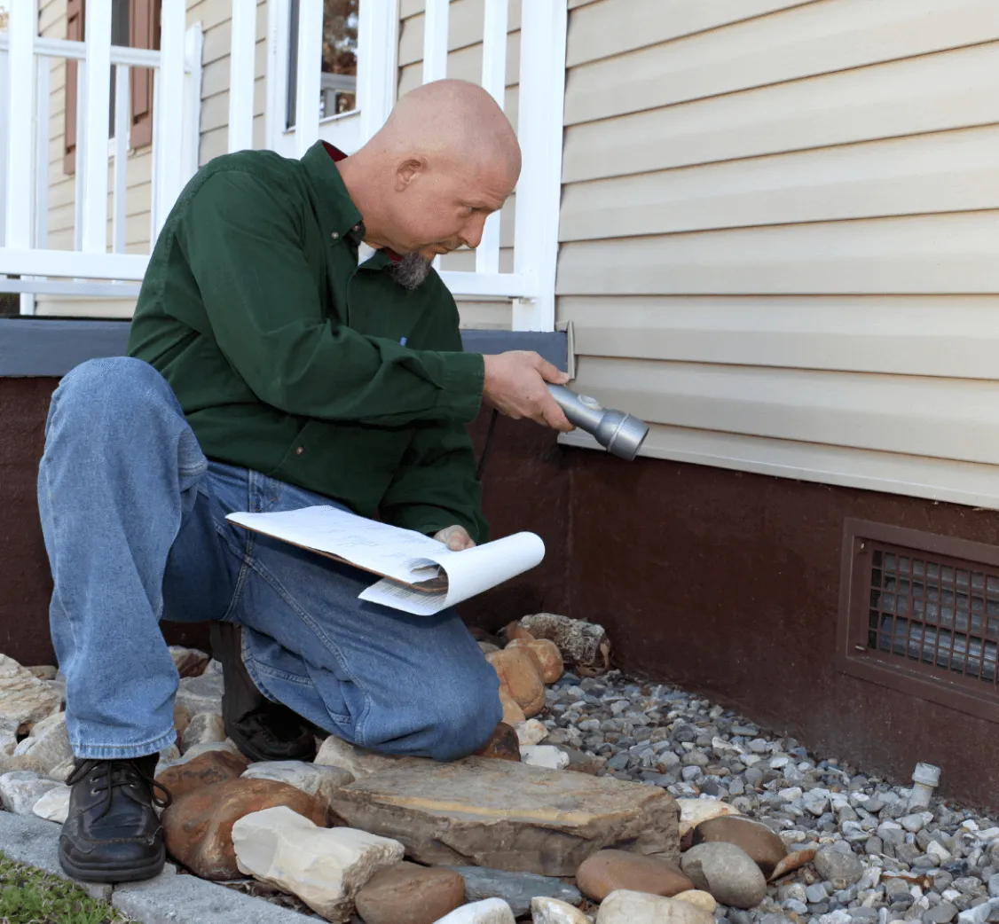
Get Clear, Actionable Foundation Insights Instantly
Use real-time topographical mapping to understand site conditions and make faster, more confident decisions on every job.
Simplify On-Site Decision-Making
Replace interpretation and guesswork with visual foundation models your team can act on immediately.
Document Conditions More Clearly
Create visual records your team can reference when planning scope, discussing repairs, or reviewing a job.
Make Faster, More Confident Job Decisions
Get Clear, Actionable Foundation Insights Instantly
Use real-time topographical mapping to understand site conditions and make faster, more confident decisions on every job.
Simplify On-Site Decision-Making
Replace interpretation and guesswork with visual foundation models your team can act on immediately.
Document Conditions More Clearly
Create visual records your team can reference when planning scope, discussing repairs, or reviewing a job.
Get Clients to Approve Repairs Faster
Get Clients to Approve
Repairs Faster
Make your recommendations easier to understand so clients and decision-makers can approve repairs faster and with fewer objections.
Explain foundation issues in a way clients and project stakeholders immediately understand.
Reduce hesitation and back-and-forth
during repair discussions.
Turn faster approval decisions into more signed work.

Make your recommendations easier to understand, so clients and decision-makers can approve repairs faster and with fewer objections.
Explain foundation issues in a way clients and project stakeholders immediately understand.
Reduce hesitation and
back-and-forth during repair discussions.
Turn faster approval decisions into more signed work.
(Demo snippets 1:42 - 8:07)
(Demo snippets 1:42 - 8:07)

Start Using SpatialVision™ on Real Jobs Today
Start Using SpatialVision™ on Real Jobs Today
Put SpatialVision™ to work on real foundation jobs with faster visualization,
clearer communication, and more confident field decisions.
Put SpatialVision™ to work on real foundation jobs with faster visualization, clearer communication, and more
confident field decisions.
hear it from your peers
hear it from your peers

Got Questions?
Got Questions?