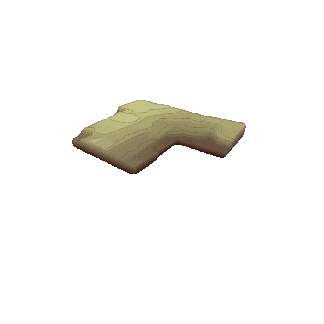
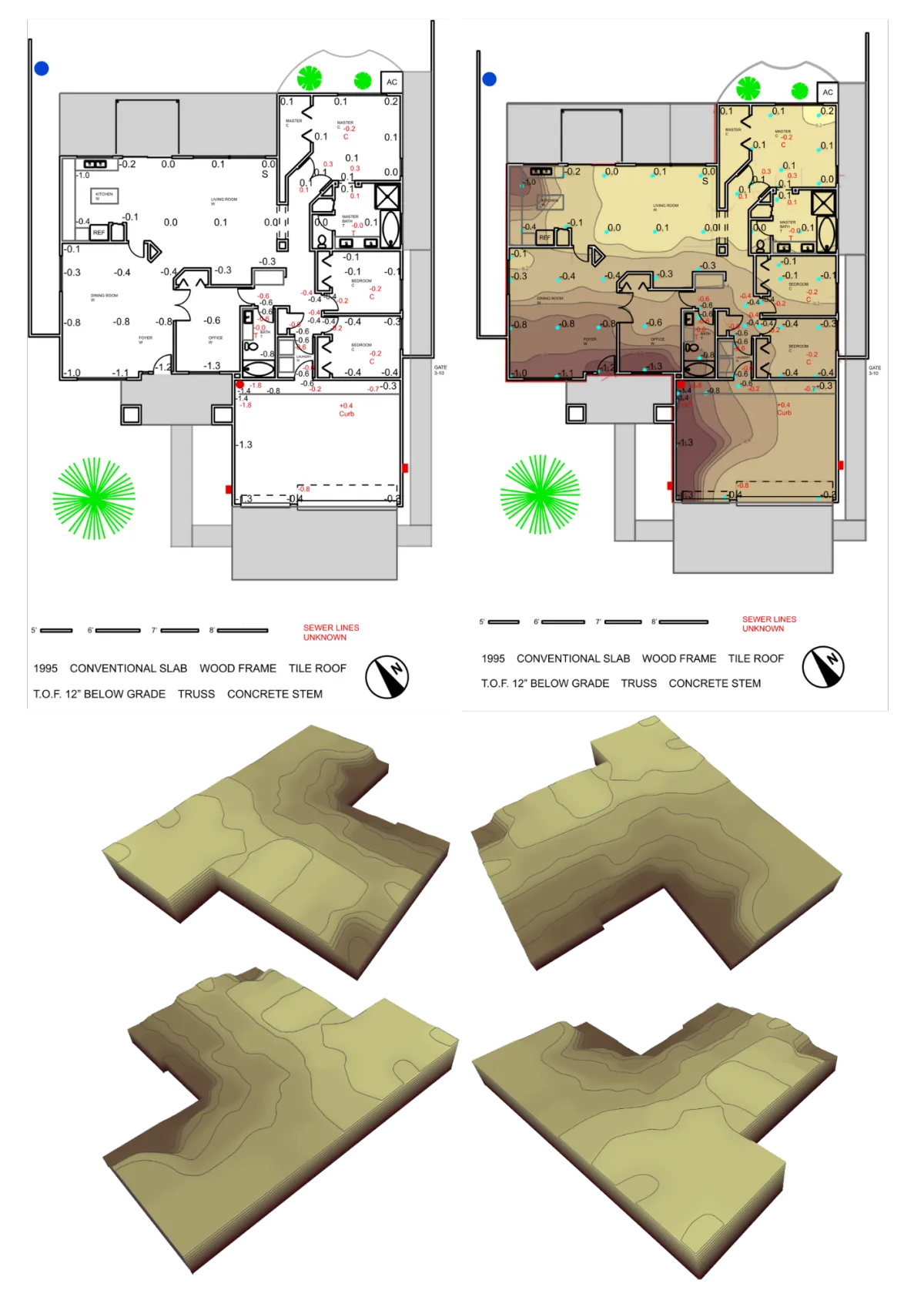
Turn Raw Foundation Data Into Visual
3D Models That Win More Jobs
Cloud-based forensic topographic modeling software
that transforms complex elevation data into clear,
professional visuals—in minutes, not hours.
Inspectors Who See
Deliver high-value foundation assessments
clients will pay premium rates for.
Contractors Who Sell
Show homeowners exactly what's wrong
and close more jobs with visual proof.
Engineers Who Solve
Automate severity calculations and deliver
geo-referenced CAD reports instantly.
Flooring Contractors Who Scope
Measure slab flatness, volume, and placement
so your bids are accurate before work begins.
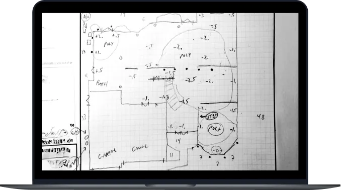
Turn Raw
Foundation data
into visual 3d models that win more jobs
Cloud-based forensic topographic modeling software that transforms complex elevation data into clear, professional visuals—in minutes, not hours.
Inspectors Who See
Deliver high-value foundation assessments clients will pay
premium rates for.
Contractors Who Sell
Show homeowners exactly what's wrong and close more jobs
with visual proof.
Engineers Who Solve
Automate severity calculations and deliver geo-referenced CAD
reports instantly.
Flooring Contractors Who Scope
Measure slab flatness, volume, and placement — ensure your bids are accurate before work begins.
inspectors
Turn basic home inspections into
high-value foundation assessments
and earn more from every inspection.
Helping you deliver the insights
your clients deserve.
Insight ● Clarity
Confidence
contractors
Generate 3D topo models in seconds,
show homeowners what matters,
and close jobs faster.
Helping you and your clients
speak the same language.
Simplicity ● Accuracy
Reliability
engineers
Perform accurate foundation analysis
with automated severity calculations
and geo-referenced CAD deliverables.
Helping you achieve more
with less tedious work.
Precision ● Reliability
Integrity
flooring
Eliminate guesswork from floor prep
and quoting — ensure your bids are
accurate before work begins.
Helping you protect margins
and avoid costly overrurns.
Reliability ● Confidence
Clarity

Powerful tool for topo modeling and forensic analysis—tailored for
Inspectors, Contractors, Engineers, and Flooring Contractors.

VS

Powerful tool for topo modeling and forensic analysis—tailored for Inspectors, Contractors, Engineers, and
Flooring Contractors.

VS
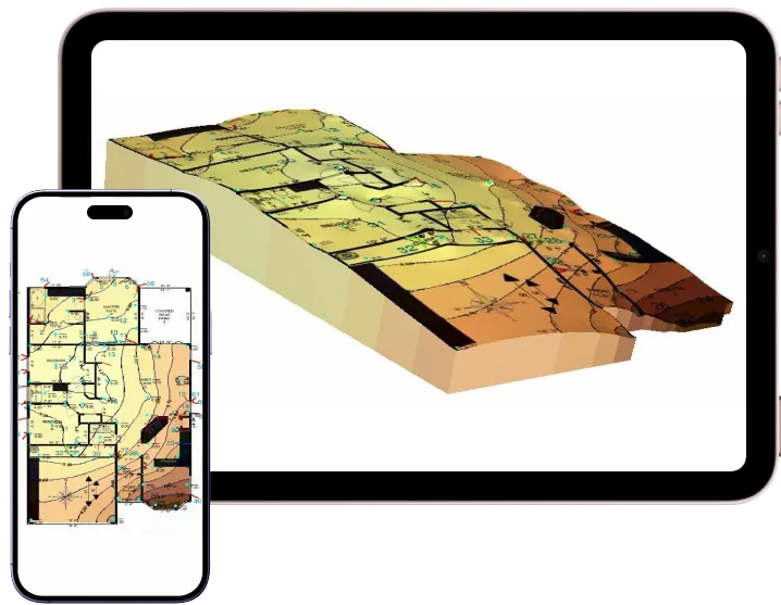
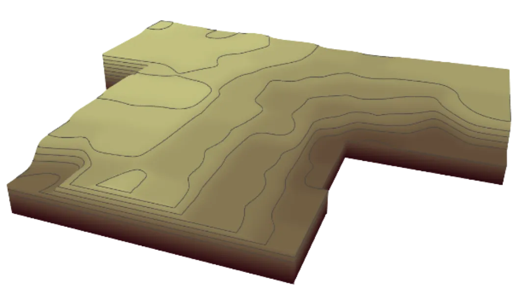
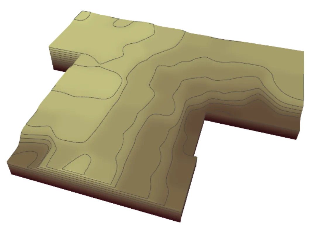
turn numbers & raw data
into colored intuitive visuals
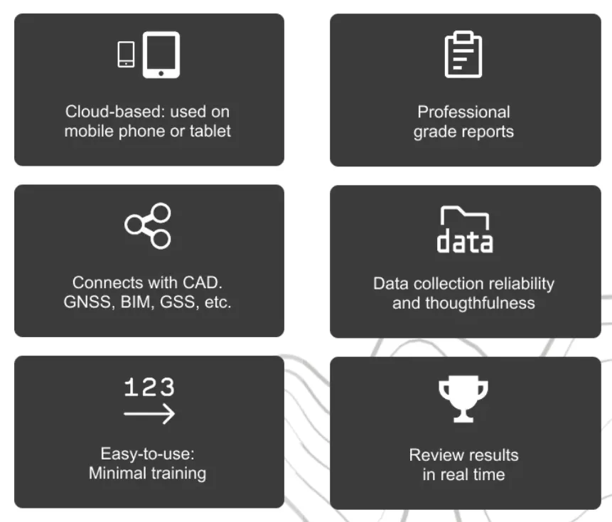
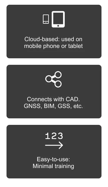
∎ Cloud-Based
∎ Instant Access
∎ Direct from Mobile or Tablet
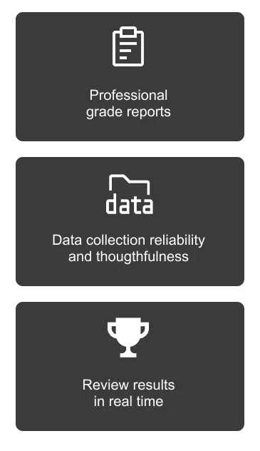
∎ Review Results in Real Time
∎ Easy to Use
∎ Connects w/ CAD, GNSS, BIM, GSS, etc.
∎ Professional Grade Reports
better planning starts
with better visibility
Contractors: More closed sales
Inspectors: More high-paying clients
flooring contractors: More PROTECTED MARGINS
Engineers: More project wins with faster turnaround
MAKE SMARTER CALLS
WITH DATA YOU CAN SEE

the precision tool for people
who build things right
TURN NUMBERS & RAW DATA
INTO COLORED INTUITIVE VISUALS
Cloud-Based ∎ Instant Access ∎ Direct from Mobile or Tablet ∎ Review Results in Real Time
Connects with CAD, GNSS, BIM, GSS, etc. ∎ Easy to Use ∎ Professional Grade Reports
better planning starts with better visibility
Contractors: More closed sales
Inspectors: More high-paying clients
flooring contractors: More PROTECTED MARGINS
Engineers: More project wins with faster turnaround
MAKE SMARTER CALLS WITH DATA YOU CAN SEE
MAKE SMARTER CALLS WITH DATA YOU CAN SEE
the precision tool for people who build things right
Subscribe to our newsletter!
Sign up today and get a gift straight to your inbox!

A subsidiary of

CONTACT
CONTACT
A subsidiary of
CONTACT
CONTACT
Copyright SPATIALVISION™ 2025 A Subsidiary of Transparent Engineered Solutions™ (TES™)
Copyright SPATIALVISION™ 2025 A Subsidiary of Transparent Engineered Solutions (TES)
Privacy Policy | Resources | Foundation Repair Secrets
Copyright SPATIALVISION™ 2025 A Subsidiary of Transparent Engineered Solutions™ (TES™)