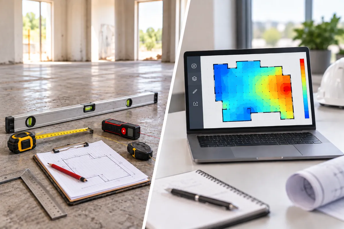
Manual vs. Digital Floor Elevation Measurement: What Changes
Manual Elevation Readings vs. Digital Floor Mapping: What Changes
Most flooring and floor leveling contractors already take some form of elevation or flatness measurement before writing an estimate — usually with an 8- or 10-foot level, a straightedge, laser, or water manometer checked at a handful of points. That approach already reflects the basic idea behind measurement-driven estimating.
The issue isn’t whether those tools work, but how much of the floor they account for, how consistently the readings relate back to the same reference, and how much uncertainty remains between the points that were actually checked.
This guide aims to answer what a manual check can and can't tell you, and what actually changes when that same approach is supported by digital floor mapping instead.
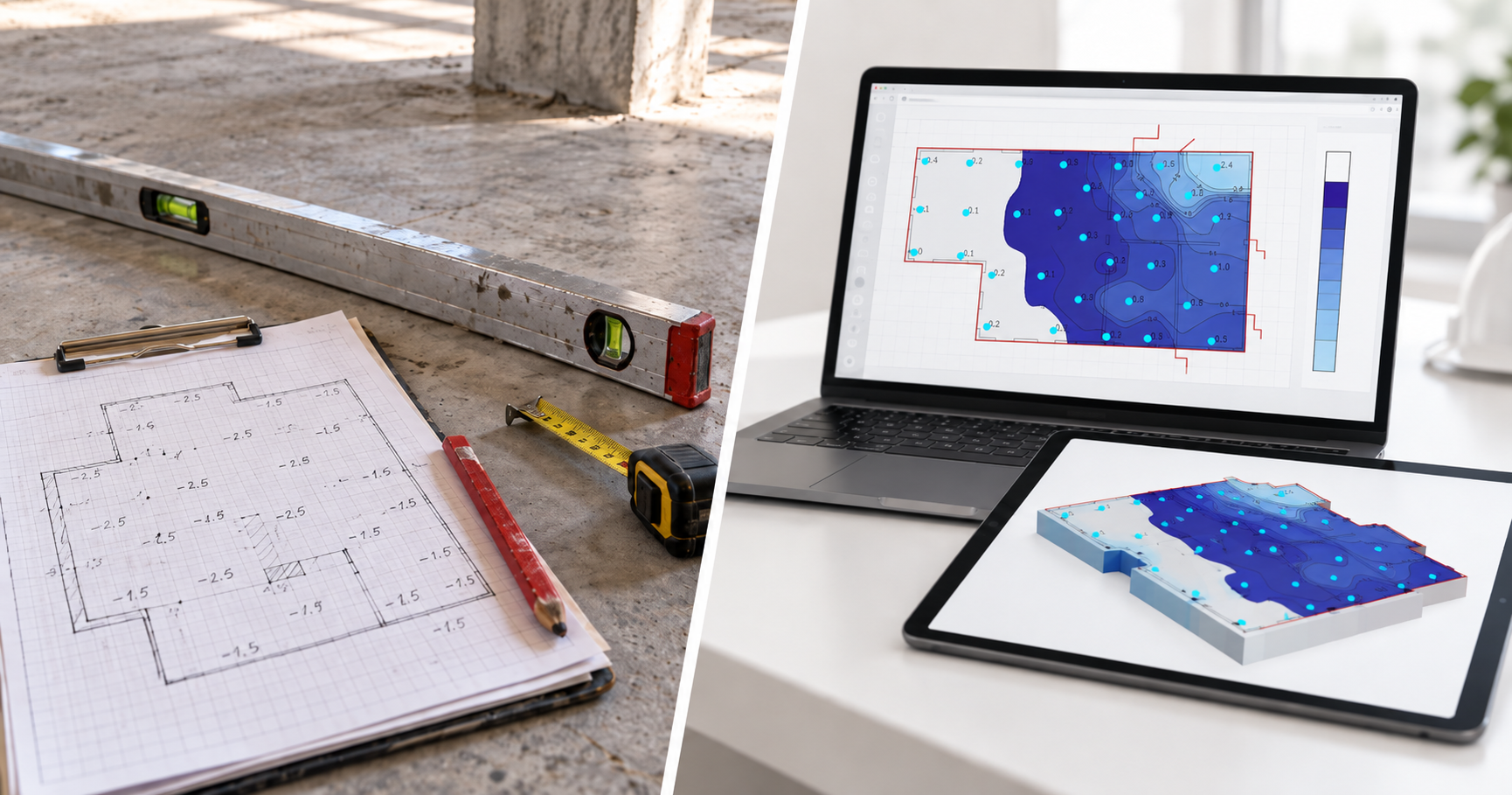
Quick Answer
A manual level or straightedge can give you an accurate read on the area directly under the tool. The limitation shows up when that information has to represent a much larger floor.
As the level moves across the slab, readings are carried forward from point to point, but the amount of floor actually measured remains limited. On a larger floor, those gaps can matter just as much as the points that were checked.
Digital floor mapping changes that by keeping measurements tied to a consistent reference and recording them spatially across the floor. Instead of a handful of isolated readings, you get a much denser picture of the slab and a better basis for making prep and quantity decisions.
Where a Manual Level Works — and Where It Starts to Break Down
A long level is still useful. It’s fast, familiar, and often tells you exactly what you need to know about a specific area.
The constraint is scale.
Once that same tool is used to build an elevation picture across hundreds or thousands of square feet, the job changes. You’re no longer checking one location. Each measurement has to relate back to the rest of the floor, and the reliability of your estimate depends on how accurately those readings carry across the slab.
The challenge is no longer the accuracy of a single reading, but maintaining a reliable relationship between readings as the measurement moves farther across the floor.
What Changes When the Level Starts Moving Across the Floor
In a leapfrog layout, one point becomes the reference for the next, and the elevations are accumulated back to the original benchmark.
That’s where small reading errors begin to compound. A 10-foot level is only accurate to roughly 1/8" over its length at best. That may be a small amount on any single setup, but each new point is calculated from the one before it. An error introduced at point three can carry into points four, five, and six.
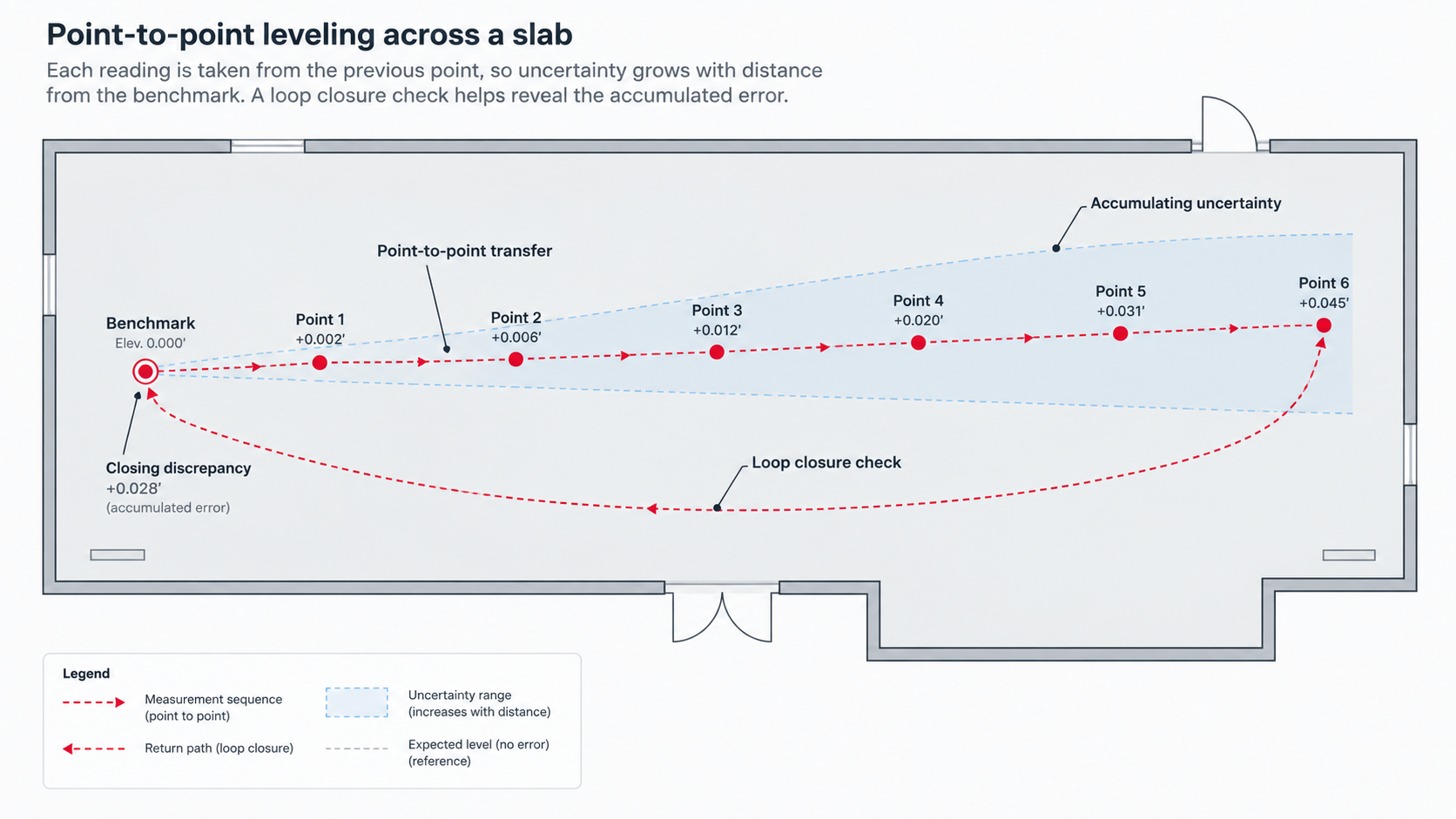
The farther the run gets from the original benchmark, the more cumulative error may be present. Closing the loop back to the benchmark provides a check: if the leapfrogged elevation no longer agrees with the original reference, the difference shows how much error accumulated through the sequence.
That doesn’t make the method unusable. It means an individual reading can be accurate enough for the span being checked while the larger elevation picture becomes less certain as those readings are carried across the floor.
The Gap Between Checked Points
Measurement accuracy is only part of the issue. Coverage matters too.
If a 5,000-square-foot floor is checked at a dozen locations, you know what happened at those dozen locations. Everything between them is still an assumption.
That’s where gradual rises, broad depressions, transitions, or isolated prep conditions can get missed. And the problem may not become obvious until quantities are being finalized — or until prep has already started.
This is the same gap The Science of Better Flooring Estimates calls deferred uncertainty: information that could have been collected but wasn't, resurfacing later at a more expensive point in the project.
The scale of that problem adds up quickly. U.S. specified commercial flooring sales reached approximately $4.968 billion in 2025. Separately, construction-industry research summarized by the American Society of Concrete Contractors has estimated direct rework at about 5% of original contract cost. Those figures are not flooring-specific measures of the same thing, so they should not be treated as a flooring rework estimate. But they do provide perspective: 5% of a roughly $5 billion market is about $250 million.
That doesn’t mean the commercial flooring industry loses $250 million a year to go-backs. It shows how quickly even a relatively small percentage becomes a large number in an industry of this size.
Not every go-back starts with an elevation issue. But when the slab turns out to be different from what the estimate assumed, that difference has to be resolved in the field.
Better coverage leaves fewer parts of the floor — and fewer parts of the estimate — to inference.
Where a Water Manometer Fits In
Between a rigid level and full digital mapping sits the water manometer. It avoids one of the biggest limitations of leapfrogging with a rigid level by having every reading stay tied directly to the same reference.
That means elevation differences don’t have to be carried forward point by point across the floor. Each location is checked back to the reservoir, so cumulative leapfrog error is largely removed from the process.
That fixed-reference setup also improves measurement accuracy. A water manometer can typically read to about 0.1", compared with roughly 1/8" over 10 feet for a rigid level.
The tradeoff is coverage and workflow. It’s still a point-by-point survey. Each location has to be reached, read, and recorded, and the final elevation picture still depends on how many points are collected and where they’re taken.
For smaller or moderately sized projects, that may be enough. As floor size, tolerance requirements, or prep risk increase, the number and distribution of readings matter more.
What Digital Floor Mapping Changes
With systems like SmartLevel, the device is zeroed to a fixed starting point and each reading is recorded directly to its location on the floor plan through the mobile app. That keeps the measurements tied to the same reference while also preserving where each reading was taken on the floor.
In the combined Smart Level and SpatialVision™ workflow, the elevation data is organized spatially as it’s collected.
This means the estimator can see more than individual highs and lows. The map begins to show the relationship between them — broad depressions, transitions, isolated humps, and how one area of the floor affects another.
The value isn’t simply having more measurements, but having enough connected information to make better prep decisions.
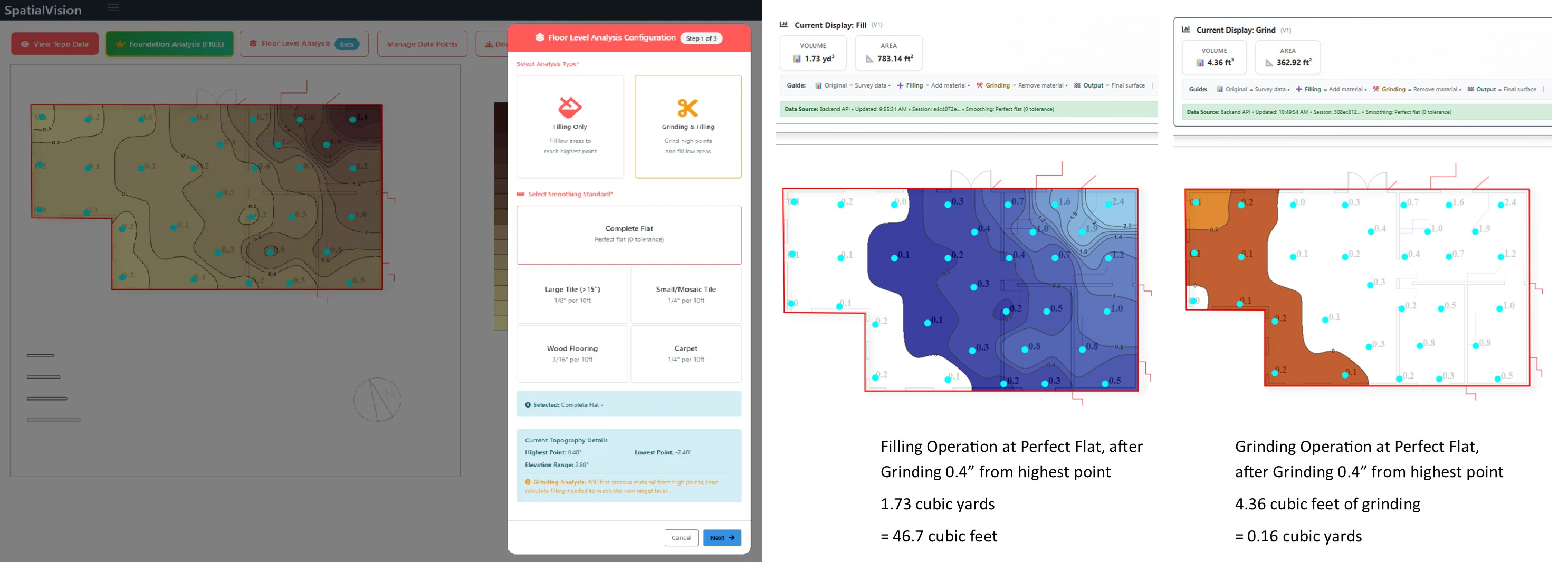
A mapped survey can give the estimator a much clearer basis for questions that directly affect the bid:
Where does grinding make sense?
Where is filling the better option?
How much area is actually outside tolerance?
How much material is the floor likely to require?
Are isolated readings representative of the surrounding slab, or are they exceptions?
That’s the practical difference between collecting elevations and having an elevation picture of the floor.
Manual Level vs. Water Manometer
vs. Digital Mapping at a Glance
RIGID LEVEL | WATER MANOMETER | DIGITAL MAPPING | |
Reference | Carried forward point to point | Direct to a fixed reservoir | Fixed throughout the survey |
Reading process | Manual, point to point, leapfrogged | Manual, point to point, read by eye | Automated, recorded digitally by location |
Typical accuracy | ~1/8" over 10' | ~0.1" | Sub-0.1", consistent across the survey |
Coverage | Limited to selected checks | Limited to selected grid points | Dense grid of readings |
Data between readings | Unknown | Unknown | Unknowns reduced through denser sampling |
Data organization | Usually manual | Usually manual | Spatially organized on the floorplan |
Best suited for | Quick checks and smaller scopes | Small-to-mid fixed-reference surveys | Larger, higher-risk, or tighter-tolerance work |
When More Complete Mapping Pays for Itself
Not every project needs a full mapped survey.
How much measurement a job needs depends on how much uncertainty the estimate can tolerate.
Three things usually drive that decision:
1. Size and complexity of the floor
The larger the slab, the harder it becomes for a limited number of readings to represent the whole surface. Multiple rooms, transitions, long runs, and irregular layouts increase the chance that important conditions sit between the points that were checked.
2. Flooring and flatness requirements
As tolerances tighten, the cost of missing a high or low area goes up. What may be insignificant under one flooring system can become a major prep issue under another.
3. Cost of being wrong
This is where the financial impact matters. If a missed condition means another mobilization, more material, added labor, schedule disruption, lost crew capacity, or a go-back, the value of knowing more before the estimate goes up quickly.
The more expensive a mistake is to correct after installation begins, the easier it is to justify the cost of a more complete, fixed-reference survey upfront.
Frequently Asked Questions
When is a manual check enough?
For smaller scopes, obvious localized conditions, or jobs with relatively forgiving tolerances, a manual check may provide everything needed to price the prep confidently. As the floor gets larger or the consequences of missing a condition increase, the issue becomes less about whether the individual reading is accurate and more about whether enough of the floor has been measured.
Why does leapfrogging create cumulative error?
Because each new elevation depends on the reading before it. Any small difference introduced at one point can carry into the next point and continue through the sequence, so accumulated error tends to grow the farther a reading is from the benchmark. Closing back to the original benchmark helps show how much error accumulated across the run.
What advantage does a water manometer have over leapfrogging?
Every reading is compared directly to the same reservoir rather than being carried forward from the previous point. That removes the cumulative-reference problem, although the survey is still limited by the number and location of points collected.
What does digital mapping add to an experienced estimator's judgment?
More complete information. Experience still determines how the floor should be approached, what conditions matter, and how the prep should be priced. Digital mapping gives that judgment a more complete elevation picture to work from.
How dense does the measurement grid need to be?
There’s no single grid density that fits every project. The appropriate spacing depends on the floor size, flooring system, tolerances, and the level of estimating confidence the job requires. The goal isn’t to collect the largest possible number of points, but to collect enough information to represent the slab reliably for the decisions being made.
Key Takeaways
A manual level can give you a reliable read on a specific area. The limitation is how well a series of those readings represents the rest of the floor.
Leapfrogging introduces cumulative-reference risk because each new elevation depends on the point before it.
A water manometer keeps readings tied to one fixed reference, but coverage still depends on how many points are collected.
Digital mapping adds value by combining a consistent reference with much denser, spatially organized elevation data.
The advantage of measurement-driven estimating isn’t point count by itself, but reducing how much of the slab has to be priced from assumption.
The more expensive a missed condition would be — in labor, material, schedule disruption, or go-backs — the more valuable a complete elevation picture becomes.
The right measurement method depends on the job. Smaller, lower-risk work may not need a full mapped survey. Larger, tighter-tolerance, or higher-risk projects often justify more complete measurement.
Conclusion
None of these methods are wrong. A rigid level, a water manometer, and digital tools all answer the same basic question — where is this floor high, and where is it low — with different amounts of accuracy, coverage, and effort.
What changes as you move from one to the next isn't the intent behind measuring. It's how much of the floor actually gets accounted for, and how much confidence you can put behind the number that ends up on the estimate.
Know enough about the floor before the estimate is written and fewer surprises are left for you and the crew to solve later.